Bay Area, Family Adventures, Uncategorized

NorCal Hikes Suitable for Toddlers & Preschoolers

We have had successful hikes with Leo on these trails… as long as it’s not naptime, and there are snacks and/or clean diapers at the ready. 🙂

Uncategorized

Vancouver vacation

Our 10th anniversary was in 2011, right after we completed a three-week road trip to move to California. We wanted to go someplace special, where we hadn’t already been – but still in the U.S. and reasonably priced. We decided Vancouver was a good choice, since we were in the same time zone and it would be a quick trip.

Unfortunately, before we really started planning the trip, we discovered that Dave’s passport was expired, and we ended up going to the Magic Kingdom (Anaheim) instead.

So finally we went to Vancouver in May 2014. Not an intentional “babycation”, but certainly sure to be our last major vacation just the two of us, for quite some time.

A brief synopsis of our trip, since there’s no time for real blogging (with all the baby planning, appointments, classes, etc in addition to full time jobs and life):

Wednesday, May 14: fly from SFO to Vancouver. Take the Skytrain to our hotel in the West End.

Thursday, May 15: Rest, get oriented. Eat lunch at a place near our hotel called Apple Deli, located in a tiny mall/food court place. Hit up Safeway to buy a few supplies, as we had a kitchen in our hotel room. Walk along the waterfront a bit. Rest some more. Head to the Alibi Room for dinner.

Friday, May 16: Get up at 5:30 am. Take bus to Skytrain to bus to ferry to bus. Finally arrive at Butchart Gardens. Enjoy the gardens for about 3.5 hours (including our sack lunch + some gelato we bought there. Take bus to ferry to bus to Skytrain. Stop at Granville Island and wander a bit, mostly trying to find a place to eat. Eat at The Keg for dinner

Saturday, May 17: Eat brunch at Joe’s Grill in the West End. Walk around the West End and stop by a salon where we both got our eyebrows threaded (Dave’s first time!) Take the bus to Stanley Park and walk around for quite a while. Take a cab over to The Fish Counter to have extremely informal sustainably sourced fish for dinner.

Sunday, May 18: Take several buses plus the Seabus (highly recommend!) to Lynn Canyon. It was beautiful but SO CROWDED. Did quite a bit of hiking and by the end of the trail we were so tired. We took the bus back to Seabus to the bus. Ate a really yummy dinner at Kingyo in the West End.

Monday, May 19: Get a ZipCar near our hotel. Hit up Tim Horton’s for some Timbits and coffee for breakfast. Drive to Lighthouse Park and hike around some ancient Douglas Firs. (So much more chill than the day before.) Drive over to Larson Bay Park to eat our sack lunch while gazing at the water. We decided to just keep driving north, since we had plenty of time and a car, and no other destinations in mind. We stopped at Shannon Falls and walked a bit. We ended up in Squamish, where there didn’t seem to be much to do. We had passed the Sea to Sky gondola, so we went back to see if we could take the gondola ride up, but it was closed for the day. So we headed back to Squamish and walked the estuary trail. Afterward we made a very unsatisfying stop at the local A&W Root Beer, then we drove back. We stopped for dinner in North Vancouver at a pretty tasty and interesting restaurant called Burgoo. On our way home we drove around the west side of Stanley Park which we hadn’t seen earlier in the trip.

Tuesday, May 20: YVR to SFO! Good trip but good to be home.

Uncategorized

Whale Seeking off the NorCal Coast

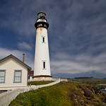
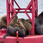
Pigeon Point LighthouseI didn’t get a chance to post a blog post back in January when Dave and I went on a 3-hour whale watch boat tour. Truth be told, it wouldn’t have been a very interesting blog post, since we saw precisely zero whales. We did have a nice boat ride, the highlights of which were a huge group of California sea lions, some beautiful common murres flying in formation over the water, and a really good look at Mavericks. We made a whole day out of it: drove down the coast afterward, had lunch in Santa Cruz, stopped at Pigeon Point Lighthouse.

I was pleasantly surprised the following Monday when I received an email from the Oceanic Society acknowledging the “regrettable fact” that we hadn’t seen any whales, and offering us the opportunity to reschedule for another tour at no additional charge. Sure, why not?

California Sea LionsSo we set out once again for Half Moon Bay and got on a boat in Pillar Point Harbor with about 40 other people, plus a naturalist and two women from the Marine Mammal Center. As before, the captain of the ship shared that previous trips that week had spotted quite a few whales, and at this time of year it is common to see mother whales with their calves returning from Baja California. We went about a mile and a half out from shore, and headed south.

This time the trip was a bit warmer, slightly less overcast, but fewer sea lions and sea birds overall. We did see harbor porpoises quite a few times – at least, their fins – but they’re really hard to photograph.

CA Coast South of HMBAfter heading south for over an hour, the captain came on the PA system with what had become a familiar announcement: “Well, folks, I don’t know what to say….” He turned toward the coast and started heading north about a half mile off shore. The shoreline on this part of the coast is just beautiful from the water – one would never know from land how cool the cliffs look below.

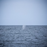
Thar She Blows!At last, someone spotted a whale! A spout, a little bit of the back… and then the whale dove underwater. The ship stopped to wait, while the captain explained that typically whales stay underwater for 3-5 minutes before coming back up for air. We waited at least 10 minutes before the captain concluded that we must have spooked it. He poked along up the perhaps empty whale highway to see if we could find any of this one’s companions, but no luck. That was our whale spotting for this trip.

Dave and I shrugged, and figured we got 6 hours’ worth of boat rides for the price of three. When we got back to shore, we got into our ZipCar and drove down past Pescadero to the Highway 1 Brewing Company, where we had a very yummy lunch. (Don’t let the menu fool you. It’s a lot of food.)

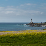
Pigeon Point LighthouseHeading back up the coast, Dave wanted to stop to get a couple of photos of Pigeon Point Lighthouse as seen from the south. I sat in the car and gazed at the ocean while he darted across the highway to get his shots. As I watched, I saw no fewer than six whale spouts! Dave saw them too, and when he got back in the car, he suggested we drive over to the lighthouse, where there’s a perfect overlook for whale spotting.

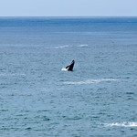
Dancing Grey Whale CalfOur luck evened out. There were quite a few whales traversing the whale highway just a few dozen yards from shore. Our timing was perfect – a calf decided to dance out of the water while we watched! We overheard the park rangers a bit later talking about how that was the only whale breech that day. Very exciting! Check out Dave’s sequence photo here.

The lesson learned is that a boat tour doesn’t seem to be necessary to see whales along the California coast, as long as you know where to go. Still, the boat was a fun time.

Uncategorized

Quest for Titans in Jedediah Smith Redwood State Park

Ever since our last visit to Jedediah Smith Redwoods National State Park, I’ve felt a pull to return. The redwoods we visited in Stout Grove were breathtaking, and Smith River calls for me to kayak or raft it.

Redwoods along Mill Creek TrailSo in considering my options for celebrating my 38th birthday weekend, I chose the redwoods. While there are a number of other state and national parks preserving old growth redwood forests, but for some reason I wanted to go back to Jed Smith, despite the fact that it’s the furthest away in the far northwest corner of California.

I did a bit of research on the internet to see what else we might see if we were to return. Stout Grove is lovely but is not enough to merit a 6+ hour drive. A glance at the park map made me wonder if the Mill Creek Trail might be a good option for me. A bit more research led me to learn about the Grove of Titans. From there, I was hooked.

To become more knowledgeable and to get more psyched, I devoured Richard Preston’s The Wild Trees in about a week. I also went to the library and photocopied the redwood section of Robert Van Pelt’s Forest Giants of the Pacific Coast for easy reference while on the trail.
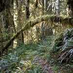
False side trailIn the meantime, I developed pregnancy-induced sciatica at 17 weeks (two weeks before the trip). Suddenly, a 5 mile hike with potential bushwhacking was looking fairly doubtful.

Thankfully, by the time we headed out of town on March 21st, I was able to walk approximately half a mile at a reasonable pace without major pain on a regular basis, so I was determined to do this trip.

So we drove up California’s beautiful North Coast and made it to Jedediah Smith Redwoods State Park mid-day on a Saturday. We came in via Highway 199 and parked near Stout Grove.

We faced a hurdle right away after we exited Stout Grove at the confluence of Mill Creek and the Smith River. It’s such an amazingly beautiful spot – on a warmer day, I could spend hours just hanging out there. But I was determined to hike the Mill Creek Trail. Unfortunately, the bridge that crosses Mill Creek during the summer is not there during the off-season. We had to take our shoes off and wade through a frigid, up to knee-deep, surprisingly powerful fast-flowing creek to get across to where the trailhead could be found. (The picture Dave took doesn’t do it justice.)

Mill Creek TrailheadIt was a little risky because we couldn’t quite tell from that side where the trailhead actually was. Once we caught our breath and put our shoes back on our damp and slightly sandy feet, we followed the footsteps of earlier hikers across the sand toward the edge of the woods, and found a short set of steps up to the trailhead.


Several trillium growing out of tree trunkThe Mill Creek Trail was the perfect choice. Even without the treasure hunt involved in seeking the Grove of Titans, the trail was lovely. It’s such a joy walking through several miles of a complete redwood grove ecosystem, including sword ferns, wood sorrel, the occasional trillium sprouting out of nowhere, and a variety of other types of trees as well.

Along the trail is a wide variety of redwoods of all ages, as well as interesting botanical sculptures formed by lichen, stumps, and fallen trees. My slow pace created all the more opportunity to take it all in.

Before long, the quest drew nigh. If you Google “grove of titans” you’ll learn that the exact location is intended to be a secret. The internet gives enough hints, though, to indicate that the grove is relatively easily found off the Mill Creek Trail.

We weren’t sure, though, quite how far we would have to go, or just how obvious the side trail would be. So after hiking for about an hour and a half – at a pace that grew slower and slower in half-mile intervals – we started glancing off to the side of the trail to see if we could locate the Grove of Titans.

We did end up bushwhacking a couple of times for a good 10-15 minutes each. I’m still a little surprised that I was able to pull it off, physically. Hopefully we didn’t do too much damage to the underbrush. It must have been very comical, had anyone been watching.

Dave was pretty convinced we hadn’t gone far enough, so once we were back on the trail, Dave sped on ahead to see if he could spot a more obvious side trail, while I poked along.

Finally he came back and described the spot where he thought we might strike gold, but then went ahead again just to see what else might be further down the trail. I came to the spot he described, and it was pretty obvious that it was the right spot. It was even more obvious when a group of 4-5 people plus two dogs (one a fluffy white dog in a backpack) took the turn off the main trail and headed off on the side trail I was standing next to.
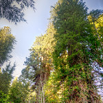
Lost Monarch (right) and El Viejo del Norte (left)Dave came back and it was not long before we got the amazing view we’d been seeking: Lost Monarch and El Viejo del Norte, the third and sixth coast redwoods alive. Our quest was successful!

The trail in the grove was a true trail – unlike the false trails that had led to our bushwhacking – though it was a bit overgrown. The folks we followed into the grove got a bit turned around, especially because the larger dog on leash decided she was going to get around however she wanted, trails be damned. We helped them find the trail again, and continued admiring the enormous trees before us.

Jenn with Lost Monarch, Grove of TitansLost Monarch is truly the more regal of the two largest Titans we found. Enormous but elegant, it’s not really possible to walk all the way around it. Looking up, about a third of the tree is really visible before a cloud of the lower branches obstructs views of the rest of its 320 foot height. I gave the Monarch a hug as requested by Renae.
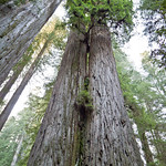

Screaming Titans, Grove of TitansAs we walked toward El Viejo del Norte, we discovered a network of small paths around the rest of the grove, including what was likely Screaming Titans. (Keep in mind this grove is not on any maps, so the trees aren’t conveniently labeled like, say, the General Sherman in Sequoia National Park’s Giant Forest.)
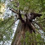

El Viejo del Norte, Grove of TitansDave and I lost each other for a bit, as he wandered around taking photos and I stood staring up into the immense trees. Although I had my photocopies from the library, they only described the few largest trees, so they were little help in identifying the others I knew to be named trees in the grove. However, I was able to provide a bit of information to our fellow travelers (one of whom was referring to El Viejo as “El Diablo”). I laid down for a while on a fallen redwood for a while staring up at the intricacies of El Viejo del Norte… and then had a really, really hard time getting back up. Stupid sciatica.

Once we finally found each other, we spent a few minutes trying to find the Del Norte Titan, the largest living coast redwood and supposedly “nearby” in the Grove. We didn’t know what direction to look, though, so we weren’t able to find it. Good reason to go back some day!

Jenn & Dave with El Viejo del Norte, Grove of TitansWe spent a bit more time admiring El Viejo del Norte, the sixth largest living coast redwood and perhaps the gnarliest redwood you’ll ever see. As Robert Van Pelt describes it in Forest Giants of the Pacific Coast, it has a LOT of character.
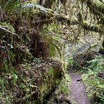

Tunnel created by fallen redwoodAt that point, I was just about done, but there was still a lot of walking left to do. Dave had also twisted his ankle during our adventure, so we shuffled along the trail for another 30-45 minutes – along trail that continued to be breathtakingly beautiful – until we got to Howland Hill Road.

I could go no further, but the car was parked about 1.5 miles north of where we were, back at Stout Grove. It probably would have taken me about an hour and a half to poke along up the road back to the car, but thankfully Dave had enough energy to power-walk back to the car. I sat on a fallen redwood and flipped through my Birds of California book for 45 minutes while I waited for Dave to come back for me.

We had come full circle. We drove south out of Jedediah Smith Redwoods State Park along the road that had entranced us the first time we visited in July 2009, again listening to Pink Floyd’s “Shine on You Crazy Diamond”.

Check out the rest of Dave’s photos here.

Hiking / Backpacking Adventures, Uncategorized

Pinnacles National Park

PinnaclesPinnacles officially became a national park just a month or so ago. Since it’s reasonable driving distance from San Francisco – about two hours – we decided we should take a little day trip. Check out the photos on our Flickr site.

We got a ZipCar and took the 280 south (because it’s usually smoother and more scenic than Hwy 101), which turns into 101. After driving through Gilroy, we got off on Route 25. It goes through Hollister, then winds through rolling foothill ranchlands. This time of year is the best in this part of California, when the hills are actually green instead of golden brown. About 30 miles later we arrived at the turnoff for the East Entrance into the park. From there it only takes a few minutes before getting to the Visitor’s Center.

When we arrived at Pinnacles we found that it was fairly busy. The entrance doesn’t have a drive-through kiosk – you have to park and go into the Visitor’s Center to get a pass. We have a National Park Pass, so all we had to do was show them our pass, and get a receipt to stick in our car.

All of the trailhead parking lots were full, so we had to leave our car in the parking lot and take the shuttle. We ate a quick lunch and then managed to be the last two people on the shuttle. While on the shuttle, I had a nice chat with my seatmate, who was a spry older gentleman who has been coming to Pinnacles with his family for decades. He and his wife gave me some great advice as to how best to navigate the trails we were considering.

The shuttle left us at the Bear Gulch day use area, where there are a number of options for trailheads.

We decided to do the Condor Gulch – High Peaks loop trail, clockwise. It’s over five miles, and reasonably strenuous in parts.

From the trailhead parking lot, there is a short, flat connector trail before the trail starts a steady but reasonable climb to begin the High Peaks Trail. It was a bit steep in places, but then the trail goes along a ridge for a few tenths of a mile. This was a great place for views of both the eastern and western sides of the park.

PinnaclesThe trail then becomes fairly steep, with a series of switchbacks leading up to a rest stop of sorts, where there’s a bench and a restroom. We rested for just a bit, admired the views, and then continued along the trail.

The trail forks here, leading down to the Juniper Canyon Trail, but we continued up and along the High Peaks Trail. The trail became rockier and steeper, and we started to encounter stair steps carved into the rock.

Turkey Vulture at PinnaclesI had been admiring the birds flying around the tops of the rocks, especially a couple of crows flying in pair formations. We got to the top of one spot on the trail and stopped for a bit to watch the turkey vultures soaring around. They were really fun to watch.

We were on the lookout for condors, knowing that one of the gems of Pinnacles is the growing population of California condors that have been released into the wild. As we continued along the trail, we came across a guy with some serious equipment and a “Pinnacles Condor Crew” T-shirt. We inquired about the condors, and he shared that there had been a bunch of them flying around a couple of hours before, but that they had since dispersed. We were a bit disappointed, but we kept a hopeful eye as we continued along the trail.

Narrow Trail at PInnaclesThen we got to the part of the trail labeled “steep and narrow”. There were more stairs, with non-OSHA-compliant handrails. It’s really hard to describe just how steep and how narrow this carved-out-of-rock trail is… you’ll just have to check it out yourself.

We reached another ridge, forked off onto the Condor Gulch Trail, and it was all downhill after that. By “all”, I mean mostly downhill for about 2 miles. it was a relief after so much slow uphill climbing, but on the other hand, our feet got really sore from the pounding!

We reached a spot marked “overlook” on the map, which was not only disappointing, but filled with noisy small children. We didn’t linger; we hit the trail, which was a much flatter downhill slope. We were back to the Bear Gulch parking lot a mile later.

I highly recommend a trip to Pinnacles! There are two reasons why, in my opinion, this park is valuable enough to have been preserved with National Park status. The presence of the California condors, which very nearly went extinct, makes it a very important wildlife preserve. It’s also geologically significant. I’m not much of a geologist, but even I could tell that some pretty interesting activity created the different formations in the park. Less obvious to the layperson is the fact that the San Andreas fault runs right through the middle of the park. (One tourist at the beginning of the trail, when learning this, remarked that it was very unsafe for people to be doing rock-climbing if the fault is running through the park. We were amused.)

It’s also just cool. For those of us who can’t get to Colorado or Utah on a regular basis, Pinnacles is a worthy substitute.

Uncategorized

Jenn’s adventures in NYC: Photos

NY Public Library with BofA Building and Grace Building in backgroundI was staffed on a project in Midtown Manhattan from late January to early May, 2011. One of my friends in Champaign-Urbana commented that it was like a paid vacation. True, except for the part where I had to work 40 hours. Though that part was fun too, of course.

I did thoroughly enjoy being in the city for a few months, especially after living in the cornfields for a year and a half. It was awesome to be surrounded by tall buildings, restaurants, public transportation, and limitless entertainment opportunities.

Check out some of the photos I took while I was hanging out in NYC.

Uncategorized

Jenn’s adventures in NYC: Restaurants and Hotels

My favorite restaurants in NYC:

Bubby’s Pie Company in TriBeCa. I had dinner here more times than any other restaurant. By the last time, the waitress was trying to remember what my “usual” drink was. Delicious food, chill atmosphere, and great commitment to sustainable and/or local food. [My Yelp review]

East of Eighth in Chelsea. Very chill, good atmosphere, good service, terrific menu. The second time I came here, I ate in the garden out back. It wasn’t breathtakingly beautiful, but it was a nice change to be able to eat in a quiet outdoor patio in the heart of Manhattan. [My Yelp review]

The Long Room in Midtown. The food here is quite good for a pub. Pretty good service, and of course a good whiskey/whisky selection. [My Yelp review]

Rattle N Hum in Midtown. Actually, the food here isn’t that great, but it is a must-stop for beer snobs. Dave was in heaven when I brought him here.

My hotel, as seen from 36th & 6th, with the Empire State Building in the backgroundMy favorite hotel in Manhattan is the Hilton Garden Inn on W 35th Street (Herald Square). I did several weeks of multi-night stay here. Extremely convenient location, wonderful staff, great views from the upper floors, and an all-around good value.

A close second, though I only stayed there once, is the Hilton Garden Inn in TriBeCa. Nice rooms, and literally right above the subway station.

I’m a big fan of the Hilton Garden Inn because of the mini-fridge and microwave in the room. Makes it easier to just have breakfast in my room instead of having to go out.

Uncategorized

JennÂ’s adventures in NYC: Lunch in Midtown

As many office workers can attest, one of the most important parts of each day is figuring out where to have lunch. This exercise can start as early as 9:15 in the morning. Unfortunately, my co-workers and I would often have this decided by 10:30 am and still have to wait an hour and a half until we could put our plan into action, stomachs growling all the while.

Here is a list of my favorite lunch places near Bryant Park:

The Kati Roll Company on 39th between 5th and 6th. My co-worker introduced me to the restaurant and the concept, and I am hooked for life. If I never have a kati roll again, I will cry. [My Yelp review]

Goodburger on 45th between 5th and 6th. I’m always a fan of fast food places that make their food from fresh ingredients while you wait. Great burgers, decent prices, and surprisingly easy to find a table. [My Yelp review]

HB Burger on 43rd between 6th and Broadway. Get there early, because it fills up quickly. Not cheap (to be expected, this close to Touristlandia), but I really liked the atmosphere and the bison burger.

Maoz Vegetarian on the corner of 7th and 40th. I’m not someone who goes out of the way to eat a falafel, but I very much recommend the ones at Maoz. It’s definitely a “to go” place – there’s no seating – but the food is very fresh and the line, though it seems long, moves quickly. [My Yelp review]

Sophie’s Cuban Cuisine (warning! clicking this link will cause Cuban music to play loudly through your browser) on 45th between 5th and 6th. My Jamaican colleague was very happy when we found this place. You can get a HUGE meal for lunch prices, or you can opt to get a couple of empanadas. Seating is available if you get there early enough.

Mai Sushi, on 41st between Madison and 5th. Another colleague discovered this for us one day, and we were thrilled for the new option. Affordable yet yummy sushi, with plenty of non-sushi options for those who want something else. Great miso soup. Excellent selection of affordable, prepackaged “to go” boxes.

Uncategorized

Jenn’s adventures in NYC: Osama bin Laden’s death

Though I typically stayed in hotels in Midtown, I just happened to be staying in TriBeCa the week of May 1.

When I landed at LaGuardia, the president had already made his announcement about the death of Osama bin Laden. I turned on the TV as soon as I got to the hotel room. MSNBC was showing footage of college-aged people gathering in a celebratory fashion in front of the White House, and Brian Williams was reporting that people were also gathering at Ground Zero. When I realized that I was less than a mile from the site, I felt a responsibility to go and check out what was happening (even though it was past 12:30 at night at this point).

I don’t know what I was expecting – a vigil? a rally? a media circus? but I knew I should take advantage of being there.

First, here are the Facebook posts I wrote when I got there:

12:50 am: I walked down to the WTC site to see what is going on. A crowd has taken over the street but NYPD is trying to keep it from getting any bigger.

1:11 am: I made it to the crowd by going around the block. It reminds me of a mosh pit.

1:13 am: People are chanting various things, including “USA”, “NYC”, and “Yes We Can”.

1:17 am: There seem to be a few 9/11 families but mostly college age people (of which more than a handful are drunk).

1:17 am: Cigars are being smoked.

1:20 am: Some guys were singing “Proud to be an American.” Now it’s stuck in my head.

1:21 am: The police are losing their barricade battle a few yards at a time. They’re doing their best to keep things contained.

1:50 am: Unlike the kids partying on the street in front of the WTC site, I have to get up early tomorrow and go to work. Hope you enjoyed my attempt at social media journalism. =)

Barricade to crowd at WTC siteTo fill in a few things: when I got there, the corner of Church and Barclay was barricaded off, and the police weren’t letting anyone pass. I tried to go around to the west, but that wasn’t the right way to go. I finally went back and to the east, and found that people had gathered on Church and Vesey. When I was leaving, the NYPD had taken down the barricade at Church and Barclay, but were trying to prevent people from walking down that block of Barclay altogether.

There wasn’t much media there when I got there, but by the time I left, I saw journalists in the middle of the crowd, interviewing people. There was a news van parked on Vesey when I left (I’m not sure which network it was… perhaps local).

It didn’t seem to me that the crowd had much purpose in being there – as though people had heard the news and just decided they needed to be with other people. There was really no focal point to the crowd, and even the chants seemed to occur spontaneously from various areas.

I didn’t get good pictures, because it was dark, and – let’s face it – I was shooting with a BlackBerry. But I tried to take some video, and this video turned out okay enough to give a sense of the situation.

There was an Op-Ed in the New York Times a few days later that I felt did a good job of explaining why groups gathered at the WTC site, at the White House, and elsewhere.

There was quite the media circus a couple of days later when Obama came to visit.

Hiking / Backpacking Adventures, Uncategorized

Prince William Forest

On our way back to Maryland from visiting friends in Richmond, we stopped for a quick hike in Prince William Forest.

It’s convenient and easy to get to – just off I-95 next to the Marine base at Quantico. There’s a $5 fee (a bit of a hassle because you have to go to the Visitor’s Center first to get a little receipt), a drop in the bucket to help defray the costs of maintaining the park. Of course, silly me, it should have been free because we JUST bought a National Parks pass – but of course I had left it at home.

Prince William Forest isn’t anything particularly special, but it’s nice to have a large chunk of protected forest land (15,000 acres) with many different trails and bike paths. The park also features campgrounds and picnic areas. Dave also learned in the Visitor’s Center that there are various small, historic cemeteries located in the middle of the forest, which are difficult to find unless you’re with a ranger (or you just stumble across one).

We hiked a trail called “Farm to Forest”, which got its name because that particular spot was once a farm, and has now been allowed to return to wilderness. I was aiming for a 1.7 mile hike, but once we got there, we realized that there were really two trails – a 1-mile loop, and a 1.7-mile extension. So, we ended up hiking more like two and a half miles. Fine for me, but maybe a little much for Lucas, since his elbow’s not 100% yet.

It was a very nice hike, and it was perfect weather. It was labeled as “moderately strenuous”, which really means it’s perhaps on the slightly strenuous side of “moderate”. There were a few ups and downs, but no major inclines or much elevation change. The trail ran along and/or crossed Quantico Creek for the middle part of the hike, which wasn’t as scenic as you might think. The best feature of the trail was all the evidence of beavers – we had never seen so many chewed trees. The beavers had obviously been quite successful, actually, because a number of the tree trunks had been chewed all the way around and had fallen. There were one or two very effective beaver dams on the creek as well. Unfortunately we didn’t actually spot any of the critters.

If you live in the DC area and are looking for a place for a quick hike, or if you’re visiting the area and are looking for a place to camp near the nation’s capital, check it out: http://www.nps.gov/prwi/.