 We left San Diego last night around 7:30 pm (as usual, a bit later than we wanted to leave) and headed for Ventura. Our friend Suzy has been working in Ventura for about a year now, and since she actually lives in San Diego, her company pays for her to stay in a hotel during the week. She generously agreed to let us stay in her hotel room before embarking on our wilderness trek.
On Friday morning we took our time getting out of bed (I actually managed to read a few chapters of the Harry Potter book I’m working on), eating breakfast, and getting ready. After gassing up the car, we finally left Ventura around 9:40 am.
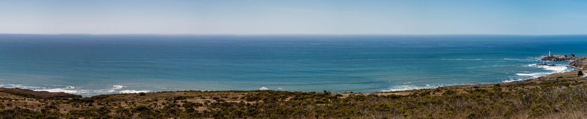
We headed up Hwy 101 along the coast, not a cloud in the sky. We got to Santa Barbara quicker than we expected, and soon exited onto Hwy 154, heading into the coastal mountains east of Santa Barbara. After about 20 minutes on a winding mountain highway, we left the highway and before long we were poking down a country road with horse ranches on either side. For about 20 minutes it felt like we were driving down someone’s driveway. Then the road narrowed and became very curvy, and for a couple of miles wasn’t even paved. The cliffs alongside the road were clearly not the most stable – there were quite a few good-sized rocks in the road. We actually ran over a couple of them – I’m amazed and relieved that we didn’t get a flat tire.
It was nearly an hour after leaving the highway that we finally arrived at Nira Campground (pronounced “n-eye-ra”, not “neera”, for some reason), where we parked our car and prepared for the hike. Just as we were getting out of the car, a huge multigenerational group of started out on the trail. We groaned, knowing that it wouldn’t be long before we passed this noisy group, which would be sure to put a damper on our intent to enjoy nature.
We took our time getting everything together, and I took advantage of the opportunity to use the restroom at the campground, knowing it would be a while before I saw it again. Finally, at approximately ten minutes to 12, we headed for the trailhead. We signed the trail register book (where we found out that the group before us had 10 people, staying 3 nights – ack!), and then started our hike.
The trail started out by crossing the creek (technically the Manzana River… really it was more like a creek) and then was a pleasant, shady walk through the flat land adjacent to the river bed.
 About 20 minutes into the hike we discovered that the trail description, which we found at santabarbarahikes.com, was not as detailed as one might hope. The map we had wasn’t much better, which we had known ahead of time anyway. At approximately Mile 1, the trail supposedly splits, one route becoming the Lost Valley Trail, and the other taking us to Manzana Narrows, which was our intended destination. When we came to what seemed to be the junction, it was unclear as to which direction to take, and there was no sign giving directions. We debated a bit, and decided to continue on the trail that we were on, rather than take the trail to the right through the bushes.
A few minutes later we came to Lost Valley Camp, which was the first campsite area on our trail map. We regained some confidence about our chosen route, and stopped at the picnic bench to have lunch.
We had noticed in the first leg of our hike that it seemed to be very buggy, and lunch underscored this fact. We had already doused ourselves in Repel bug spray (ick!) but found ourselves constantly having to wave our hands around our faces and heads to keep things from flying into our eyes, ears, nose, and mouth. As we ate our salami and cheese on sliced baguette, we got into a bit of a scuffle with a bee, who luckily didn’t get pissed off enough to sting us. It wasn’t a very relaxing lunch, so we were ready to continue our hike pretty quickly.
As we left the Lost Valley Camp, there were a couple of trail markers, which we found comforting on the one hand; but there were also several trails, which made us doubt our way. It didn’t help that – and this was true of the entire trip – the trail markers just said “TRAIL” and didn’t actually indicate the name of the trail.
But we forged ahead. The river bed was flanked on both sides by some hills, and the trail now started to climb up into these hills and follow the contours of these hills, about halfway up them. This made me doubtful again, since we had gotten the impression from the trail description that this would be a fairly flat hike (following the river, right?). Instead, we were going up and down. Also, we were hiking along a hot, exposed, very sunny and dusty hillside, instead of near the water. It didn’t seem like we were heading the right direction at all.
After another mile (by now it was about 1:40 pm) we arrived at Fish Camp, which was the second campsite on our trail map. Once we arrived here, we felt much better about the route, because there were no branches off the trail after this. However, we were somewhat nervous, because it had been a mile since we last saw water. When we arrived at Fish Camp (ironic name, really) we crossed a bone-dry river bed – probably 50 yards across of rocks and more rocks. When the trail left Fish Camp it doubled back and crossed the dry river bed again, and we continued flat for a bit and then back up and down the hills.
We started to really get worried as to whether we would have access to water again. We had brought a couple of liters of water to drink on the hike in, expecting that we would be able to pump more water (using our portable water filter) for dinner, breakfast, and the hike back. We took a break in a shady spot on the trail underneath a manzanita tree and talked about it for a few minutes. It had been 2-3 miles since we left Lost Valley Camp, the last time we were able to access water. For most of the hike since then, we hadn’t even seen water, and the few times we did, we were 100 feet above the river, with no way of climbing down to it (and especially no way of climbing back up). Dave was optimistic that the trail would come back to the water, so we continued down the trail.
At about quarter to 3, we heard a couple of interesting noises. The first was the sound of men yelling, as they sometimes do in testosterone-filled situations. We had caught up to the large group. (We saw about four people camped at Fish Camp, and we wondered if that might have been some of them, but it turned out we were wrong.) Apparently the group was setting up camp, which we were very glad to see, because it meant they would be nowhere near our camp.
 The other interesting noise was – hallelujah! – the river. We walked a few yards past the spot where the group was building their camp (and trying, apparently, to create firewood out of a fairly large tree branch) and pumped some water. Feeling much better about the situation, we continued along the trail.
The trail truly followed the creek from this point on, though at some points it was a good bit above the water line. There was quite a bit more vegetation and the scenery varied a bit more than it had earlier in the hike. Plus, the sun was now starting to disappear behind the hills to the west, so we weren’t as hot and thirsty as before. As we hiked, we saw a lot of evidence (i.e., droppings) of various wildlife, including bears. We pondered the likelihood of coming out of this trip with our very own bear story.
We arrived at Manzana Camp, which was approximately Mile 6, around 4:00 pm. My muscles had gotten sore miles before, but I was really starting to bonk at this point. There was nobody at Manzana Camp, and I said, “Can’t we just stop and camp here?” Dave said, no, we can make it one more mile to Manzana Narrows. He pointed out that we hadn’t made it all the way to our intended destination on our last trip, so this time we want to try to make it all the way.
 (It was during this last mile that we saw this flower, which was really cool, growing sideways out of the hill. It looked like someone had just spray-painted it.)
So, we continued slowly along the trail (I swear the whole trail was uphill, other than the flat part in the first mile), and finally made it to Manzana Narrows, at around 4:45 pm. We were there for about 30 seconds – there were already people there, setting up camp. “We have to go back to Manzana Camp,” I said to Dave. “We came here to get away from people, and so did they.” So, even though I was totally exhausted from hiking 7 miles (that were MUCH less flat than I’d been expecting), we hiked one more mile back to Manzana Camp. It was still deserted, so we had the whole place to ourselves.
We got to the campsite around 5:30 pm, when darkness was truly descending. We set up camp and started cooking in the dark, Dave enjoying the headlamp he borrowed from one of his co-workers. The “shell pasta surprise” that I had prepared for dinner totally hit the spot (anything is delicious for dinner when you’ve just hiked 8 miles), and we had a couple of pieces of Halloween candy for dessert. Then we cleaned up, consolidated all our stuff into the vestibule of our tent, and then got into our sleeping bags. We considered trying to play cards, but there’s just not enough room in our tiny backpacking tent. We read for a little while and went to sleep around 8 pm.
